Exploring San Francisco's Marina District
San Francisco is a city of different stories. Last year, I explored the maritime history of the city and got confined to its touristy spots. This year, I was with Anna and Joycelyn, exploring the Marina district. It's the third time I'm in this part of the city but it's Anna and Joyce's first time.

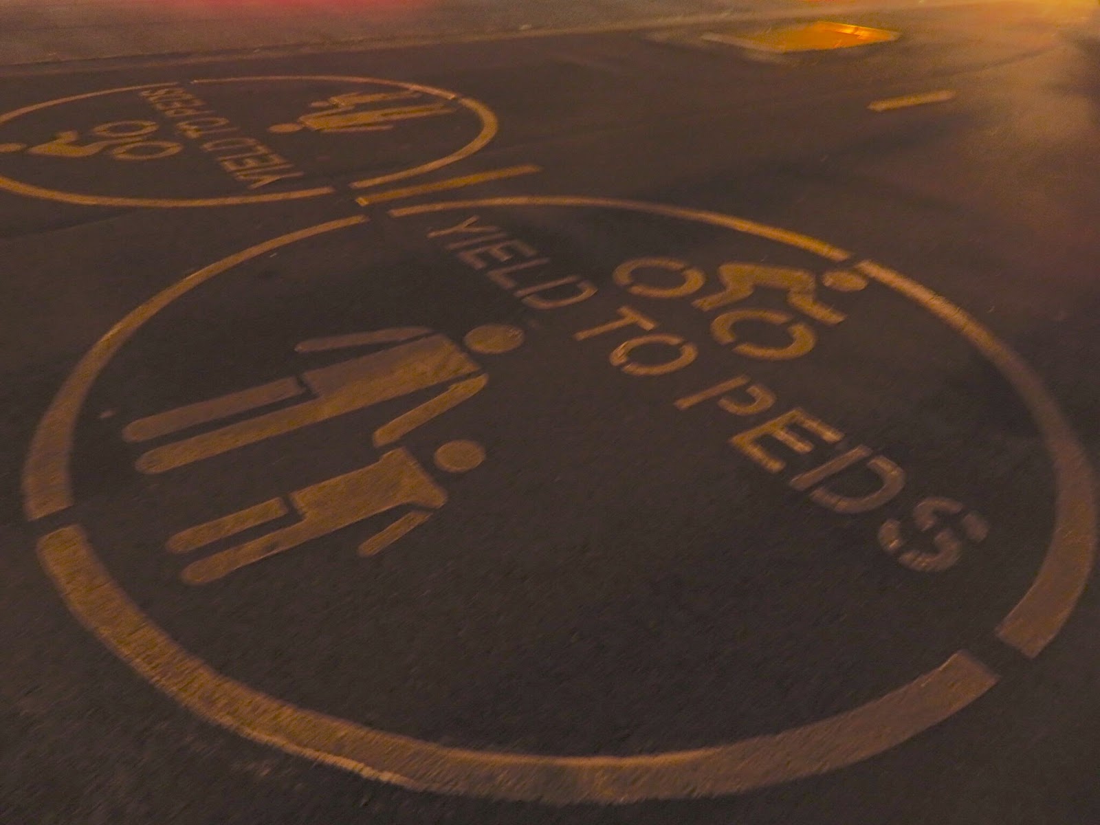
San Francisco is known to be a very pedestrian-friendly city. While walking along the marina, I noticed these signs, reminding cyclists that the path is shared with walkers.
Our first stop was the Palace of Fine Arts. Back in 2005, I was chased by a swan here back in 2005 when I was walking here with my parents and with Donnell. I can't believe that this is Joycelyn's first time to visit the place! Anyway, this spot used to be where the 1915 Panama-Pacific Exposition was held. But only the palace of fine arts is still in the same spot... we, who arrived a century too late, could only imagine how grand the exposition must have been when it was in full swing.
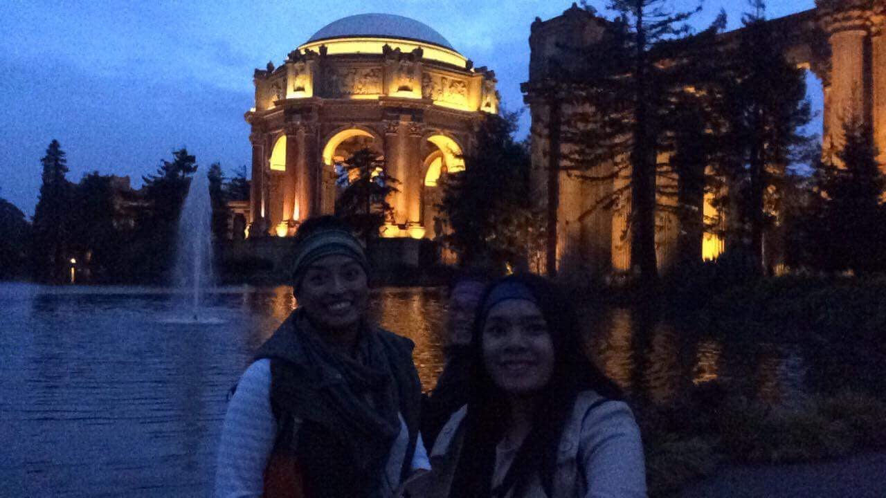
I was kinda sad that this was a missed opportunity to take animal photos because the sun has already set. There were swans and ducks in the lagoon. They were so used to people feeding them that they kept approaching us as we neared the water line. Despite the missed opportunity, I was excited to see, once again, the building bright against the darkening sky.

Turning our backs from the Palace of Fine Arts, we started seeing the houses slowly being lit from the inside. The people living here must be very rich. They have some of the best views of the city and they seem to live in a less crowded, relaxed, section. It's a sharp contrast to the density and lively vibe of the city's Mission District. This is definitely the place to go to if we want to take a breather after an exhausting day in the city.

Further down the marina is Crissy Field. Because it was dark and the fog was getting inland, part of the Golden Gate Bridge was not visible from the beach area. Yes, I was at the beach again in winter! The water, however, was calm... the beach at Carmel-by-the-Sea had bigger waves. The last time I was near the bridge, the water was more turbulent. That's probably because I was on the other side of San Francisco relative to the bridge.

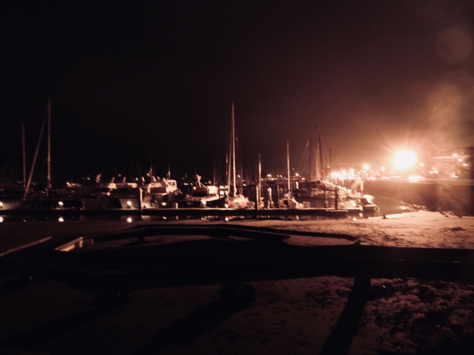
As our walk, towards Fort Mason, wound down to a close, we passed by a yacht club. There was a number of boats docked in the area. It reminded me of the Nyhavn district in Copenhagen. I could just imagine the view of the strait from this yacht club in the morning... the view must be extra special in summer because the fog is so thick at that time (I still have to see that).
It was a fun walk with Anna and Joycelyn, a perfect way to burn off the calories we ingested from Taqueria El Farolito. The temperature was dropping quite fast, which was why we opted to go back to the East Bay area by BART.


Comments
Post a Comment
Thank you for dropping by!
Before moving on, please share your thoughts or comments about the post. :)
Thanks again!