La Porte de Non Retour
Bénin used to be known as the Kingdom of Dahomey before the French colonised it. Prior to this trip, I got intrigued by its involvement in the slave trade... that has led to the diaspora of Africans into different parts of the world, mostly in the Americas. However, my knowledge about this is highly limited. I have encountered stories of African-Americans demanding for equal rights and justice... and I've seen the monuments erected at San Jose State University, lauding African-Americans who, in the past, weren't recognised for the achievements they earned.
But I know very little about how it all began. My interest was piqued because the Philippines didn't have a strong history of slave trade despite the Spaniards colonising the country. There must have been some slave trade in the country when warring tribes had prisoners of war... but this has not been discussed in detail in history class. The African experience was more widespread and documented.
But I know very little about how it all began. My interest was piqued because the Philippines didn't have a strong history of slave trade despite the Spaniards colonising the country. There must have been some slave trade in the country when warring tribes had prisoners of war... but this has not been discussed in detail in history class. The African experience was more widespread and documented.
For people interested in learning more about the African slave trade, a drive to the city of Ouidah, where the Route des Esclaves is, was in order. The first stop in the route is the Place Chacha, fronting the mansion of Francisco Félix de Sousa. He was a Brazilian trader who somehow ended up in Ouidah and became the "greatest slave trader" in the country's history.

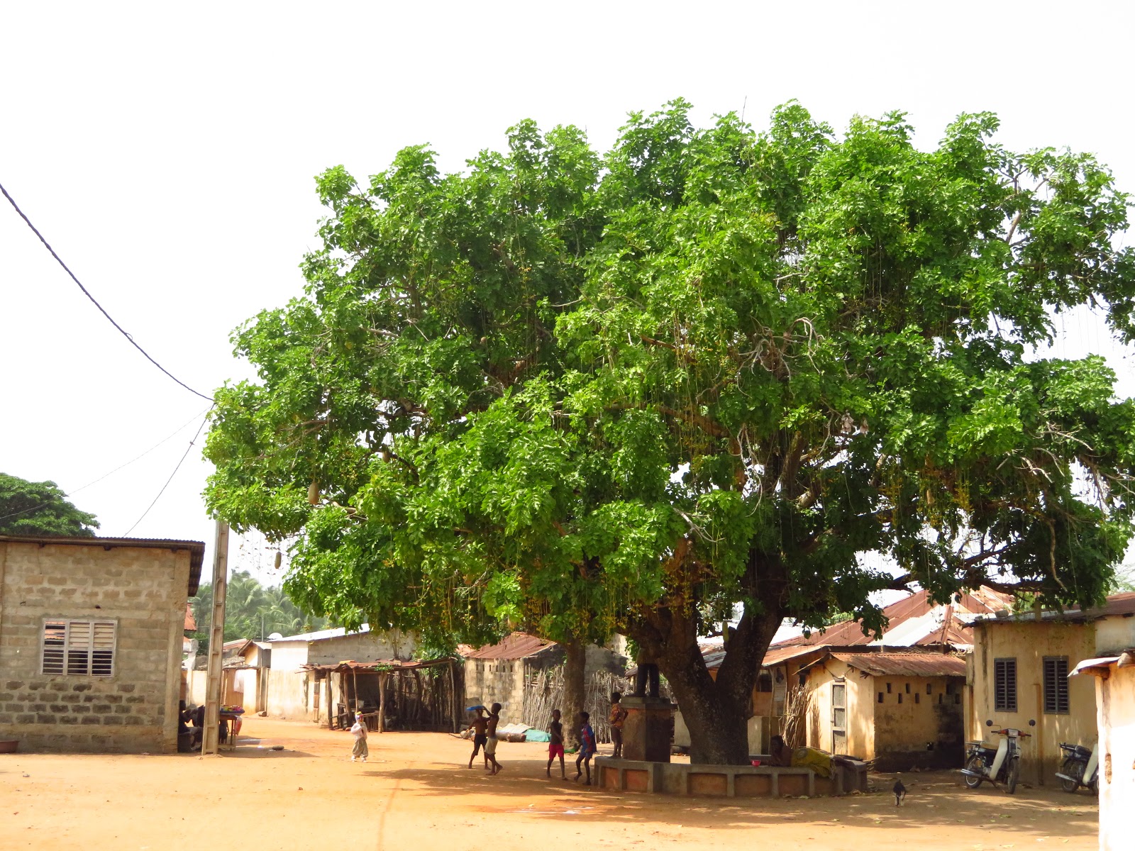
The tour guide said that in this plaza, negotiations for slaves were conducted under a massive tree. A mirror, for instance, was traded for more than 50 slaves. I was flabbergasted! I can't get my head around the idea that people were treated like sheep or cattle... worse: as inanimate objects! But then, the trade happened at a time when colonists and powerful locals were driven by greed and treated people who weren't white or their tribesmen less like humans and more like property in different parts of the world. This surely doesn't justify the situation but puts context into it. And as I listened to the tour guide, it wasn't just colonists who were wrong. Anyone who enabled the slave trade, whether colonist or local, was at fault too.


After this stop, we followed the route, a dirt road leading to the sea. I was told that the government has kept the road in this state to show the conditions slaves had to endure during their trip to the sea. It reminds me a lot of the Death March in the Philippines which killed many prisoners of war back in World War II.

The route was marked by statues that represented formers kings of Dahomey. However, instead of their life-like features being on display, the artists developed sculptures based on imagery and symbolism. Many of these sculptures, I felt, were designed to tell visitors about the strengths of these leaders or about the morals that citizens ideally must value (somehow, this brings me back to the Jose-Rizal-vs-Andres-Bonifacio-for-national-hero debate from when I was in college).


These statues also reminded me of the Stations of the Cross but without the need to offer prayers.
There was a tree where the slaves were said to have gone around numerous times in an effort to make them forget who they are. I think that this is a symbol, of course. It's a rite of passage, more likely, that tells these slaves that once they pass this tree, they cannot return home anymore. That tree has since been stricken down by lightning; it is now marked by this mermaid-like image.
There was a tree where the slaves were said to have gone around numerous times in an effort to make them forget who they are. I think that this is a symbol, of course. It's a rite of passage, more likely, that tells these slaves that once they pass this tree, they cannot return home anymore. That tree has since been stricken down by lightning; it is now marked by this mermaid-like image.

And then there was another tree where the slaves had to go around numerous times for a second time. This time, however, this rite of passage was meant to comfort those going to the boats... The slaves themselves won't be able to physically go home after going around the first tree. But by going around the second tree, the slaves were assured that their spirits could go back home.
The story being shared by the tour guide was quite heavy. This is, after all, a story of a people displaced and whose descendants are searching for their identity. But what I found more fascinating about was that this place is an actual living and breathing community. People are residing in this village. The houses were not converted to souvenir shops or restaurants.


In short, although this place may be a tourist draw, it doesn't have the commercial feel of a tourist spot.
We came across a large monument dedicated to those who did not survive the trip to the sea. This site was actually an archeological dig site where scientists discovered the remains of a common grave. Can the identities of these people be determined? With the technology available now and with a living descendant, it might be possible to find clues about them.

This is probably why many African-Americans searching for their ancestry travel all the way here... to find who they are.
At long last, for the survivors of the harrowing trip, they arrive at the coast of Ouidah. Today, La Porte de Non Retour is marked by a monument featuring a frieze of bas-reliefs representing slaves facing the sea.

I wonder if the people going into the boats literally didn't look back. Perhaps, they were dejected or they were resigned to their fate halfway across the world. We will never know. All we know is that the African chapter of their stories ended here and a new chapter was about to begin.
There's no catharsis (yet) in this story. It feels unfinished. It's one of those rare times that I didn't feel excited to see the sea. Perhaps, the closure that people are looking for will be achieved by the current descendants of these slaves, who fly back to rediscover their history. Only time will tell.


Comments
Post a Comment
Thank you for dropping by!
Before moving on, please share your thoughts or comments about the post. :)
Thanks again!